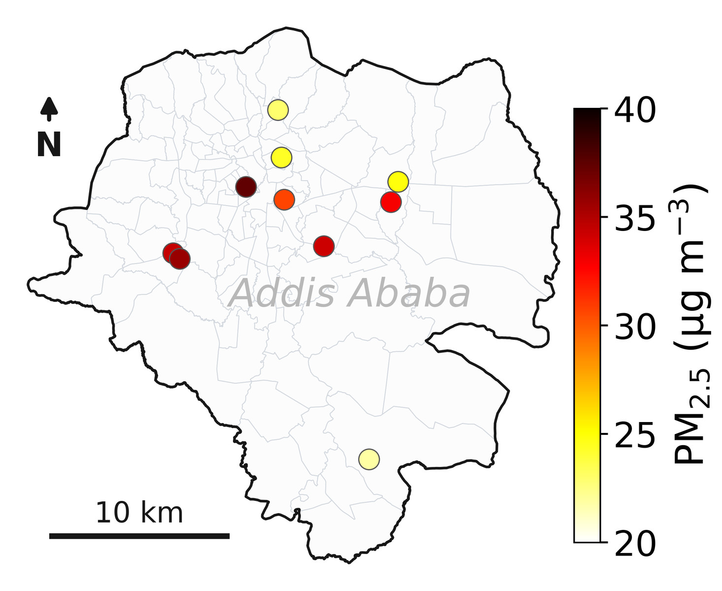
NASA's Multi-Angle Imager for Aerosols (MAIA) mission has deployed ten sensors throughout Addis Ababa, Ethiopia, to create a highly detailed map of the city’s air pollution levels. These MAIA sensors began collecting data over a period of three years, meticulously measuring particulate matter with a size range of 2.5 micrometers or smaller. The project represents one of the most comprehensive analyses ever conducted regarding air quality within Addis Ababa. Scientists are utilizing this granular information to understand the sources and distribution patterns of pollutants in the Ethiopian capital. This ongoing monitoring will contribute significantly to efforts aimed at improving public health outcomes related to air contamination.
Continue reading at www.nasa.gov
This PlaneNews briefing summarizes reporting originally published by www.nasa.gov.
Read the original article →