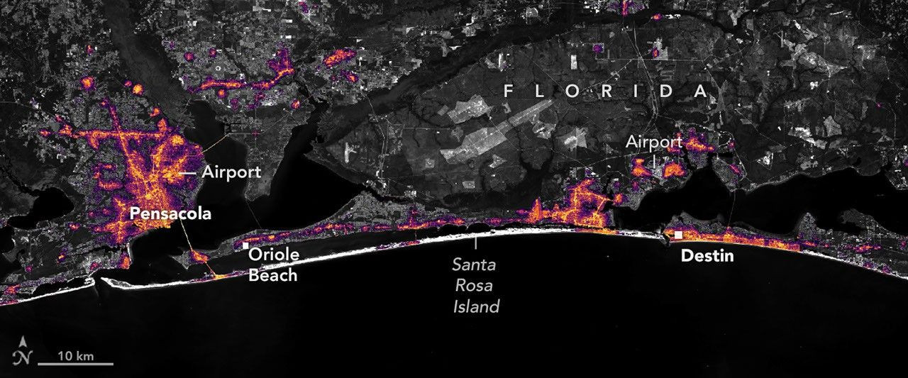
Hurricane Isaias made landfall on August 3, 2022, bringing significant impacts to the Gulf Coast region. High-resolution satellite imagery captured detailed data regarding areas experiencing widespread power outages in the Florida Panhandle following the storm’s passage. These high-definition visuals demonstrated the precise locations where electrical infrastructure was disrupted by the hurricane's force. Notably, the rapid restoration of power was also documented through these same nighttime light measurements. The images illustrate a swift recovery process as electricity returned to homes and businesses across affected communities.
Continue reading at www.nasa.gov
This PlaneNews briefing summarizes reporting originally published by www.nasa.gov.
Read the original article →